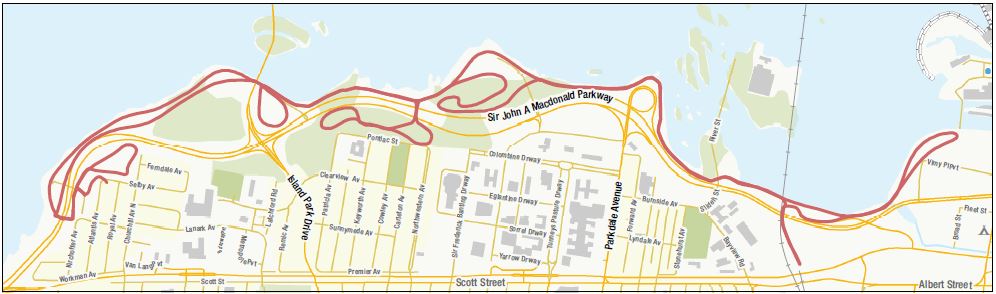
Kichi Sibi Winter Trail
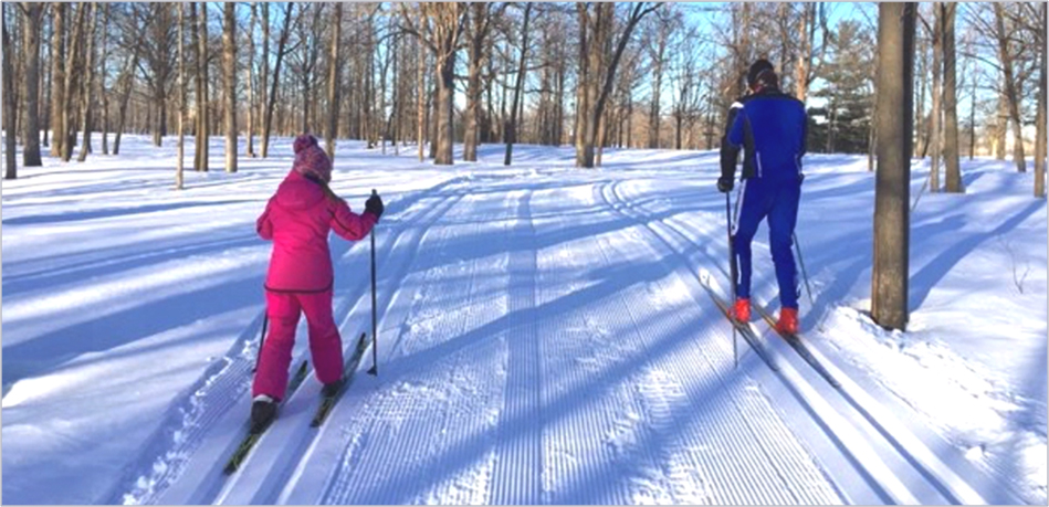
5 stars for the sky, snow, sunset - skiied at sunset from westboro beach.
The base was very firm, hard but not icy at all. There is a slight crust on the snow. So when striding the basket on the pole might catch on the edge of the snow. Not terrible but a factor.
Great glide. Trails away from the river 1, 2, 5, 8 had excellent classic tracks set. This was not the case by the river - I assume this is because the base is so hard and and the wind is strong.
There are classic tracks but they are thin and you have to pay attention to stay within. It looked perfect for those skate skiing, walking to work or riding a fat bike. The wind was very strong. You can make good time heading East!

The Kichi Sibi Winter Trail is a groomed multi-use winter trail that stretches along the Ottawa River Capital Pathway, from the Lebreton Flats just west of Parliament Hill to Dominion Station. The trail welcomes all users whether they are walkers, skiers, runners, snowshoers or fat bikers.
Two tracks are set for classic cross country skiers. Between these tracks, the trail is groomed for snowshoers, walkers, runners, skate skiers and bikers. The walking track follows the existing pathway’s route. Serpentine loops increase the distance to the ski track at the Selby Plains and Remic Rapids greenspaces and at open lands adjacent to the War Museum and Champlain Bridge, for a total trail length of more than 16 kilometres. Points of interest along the trail include the Westboro Beach tobogganing hill, the John Ceprano rock sculptures and the café at the War Museum.
The trail is easily accessed. Running parallel to the O-Train Confederation Line, convenient connections to public transit are available at: Pimisi, Bayview and Tunney’s Pasture stations. Buses run to Dominion Station (future Kěchě Sěbě LRT station) as well. Parking spots are located at Westboro Beach, Champlain Park and the Canadian War Museum.